Sandvik TIM3D drill navigation system ensures the hole quality and hole position accuracy in all drilling tasks. It bases on the most accurate multi-satellite system, RTK GNSS (Real time kinematics global navigation system). The system accuracy is better than 10 cm.
TIM3D reads a drilling plan made in IREDES format (International Rock Excavation Data Exchange Standard). The drilling plan file is transferred to TIM3D with USB stick or it can be created through the display. When the actual drilled geometry is saved to TIM3D, it can be transferred back to the office in IREDES format for further actions.
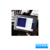
In i-Series drill rigs the system is integrated to standard screen. In “classic or hybrid” series drill rig the additional screen is mounted to the cabin.
The system consists of three essential operations (rig navigation, feed alignment and drilling) to assist the driller to improve the whole drilling process and cut of the production costs in every job site.
TIM3D is available with the optional Automatic feed alignment system. When the drill has been trammed to the proximity of the hole to be drilled, the function can be activated with single click of the hole to run button. This activates automatics and take the feed is correct position and alignment.